
Berkeley ZIP Coverage, Area by Area
Berkeley's ZIP coverage includes ordinary delivery areas, fringe areas, PO-box or special-use codes, and a unique institutional code. The research identifies the postal scope for each code but does not name a branch station for every row. The post-office column therefore says USPS route rather than guessing a station. The code is useful for an address check, yet its area label should be paired with the city line and county before a resident or parcel record is chosen.
| ZIP Code | Areas Covered | Post Office | Notes |
|---|---|---|---|
| 94701 | Berkeley PO boxes | USPS route | Not a normal situs neighborhood |
| 94702 | West and Central Berkeley | USPS route | Postal, not civic, boundary |
| 94703 | South and Central Berkeley | USPS route | Cuts named neighborhoods |
| 94704 | Downtown, campus edge, Southside | USPS route | Includes City Hall and Permit Center |
| 94705 | Elmwood, Claremont, and southeast Berkeley | USPS route | Extends into Oakland |
| 94706 | Albany and northwest fringe | USPS route | Principally Albany with some Berkeley edge |
| 94707 | North Berkeley, Thousand Oaks, and Kensington | USPS route | Extends into Contra Costa County |
| 94708 | Berkeley and Kensington hills | USPS route | Crosses the city and county line |
| 94709 | Northside and North Berkeley | USPS route | Campus edge can be confused with 94720 |
| 94710 | West Berkeley and waterfront | USPS route | Near Albany and Emeryville boundaries |
| 94712 | PO boxes and special use | USPS route | Not a situs neighborhood |
| 94720 | UC Berkeley | USPS route | Unique institutional ZIP and UCPD context |
The table is a coverage key, not a count of residents or parcels. 94701 and 94712 should not be read as ordinary neighborhood areas. 94720 points to UC Berkeley's institutional context. The other rows still need an address-level check because a ZIP can carry Berkeley in the mailing line while the physical situs lies in Albany, Oakland, Kensington, or another neighboring jurisdiction.
Berkeley ZIP Boundaries Have Quirks
A postal code follows a USPS delivery system. It does not promise that every address carrying the code sits inside Berkeley, and it does not make every Berkeley neighborhood share one code. South and Central Berkeley are cut by 94703. North Berkeley, Thousand Oaks, and Kensington appear together in 94707 even though the route crosses a county line. The hills in 94708 do the same. West Berkeley and the waterfront use 94710 near other city boundaries.
PO-box codes add another trap. A PO-box address can identify a delivery point without identifying the situs of a building. A mailing address can also differ from the property address in the Alameda parcel result. For a resident lookup, record both values and label them. For a civic record request, use the city or county tied to the physical event, not just the ZIP printed on a letter.
Note: The researched ZIP list contains no authoritative per-ZIP resident counts or dated realignment statistics, so none are supplied here.
94705, 94707, and 94708 Cross Lines
The most useful Berkeley postal comparisons are geographic. 94705 reaches Elmwood, Claremont, and southeast Berkeley, then extends into Oakland. 94707 reaches North Berkeley and Thousand Oaks before entering Kensington and Contra Costa County. 94708 covers Berkeley and Kensington hills. Those overlaps can change which city, county, assessor, permit desk, police agency, or court record is relevant.
94706 is principally Albany with some Berkeley edge, while 94710 sits in West Berkeley and the waterfront near Albany and Emeryville. A neighborhood name is not enough to resolve that edge. Use the USPS address result, then the Berkeley city line and Community GIS, then the county system. If the address is outside Berkeley, stop treating a Berkeley-themed search result as a Berkeley city record.
Query Berkeley Parcels by ZIP
The Alameda property search is address or APN first. Its captured controls are Parcel Number, Type Ahead Address, Property Address, Search, and Reset. No public owner-name field is displayed, and the tax portal does not offer a ZIP-wide mode. Berkeley GIS exposes a SitusZip field in its public parcel data, which can help sort or query parcels after the physical location is established. An APN, such as 57-2021-1 with sortable form 057 202100100, bridges GIS, assessment, and deed work. It is not a postal address or occupancy proof.
| Field or control | Type | Use in a ZIP check | Limit |
|---|---|---|---|
| Parcel Number | Text or mode | Open a known APN | Needs an APN, not a ZIP alone |
| Type Ahead Address | Autocomplete | Choose a postal address | Select a suggested address |
| Property Address | Text or mode | Start with a situs clue | Address-first, not owner-name search |
| SitusZip in GIS | Parcel data field | Sort or filter mapped situs records | Does not create a household list |
| Search or Reset | Buttons | Run or clear the query | Portal controls only |
Treat the APN as the bridge when a ZIP search finds the right parcel but the mailing line is confusing. Preserve the situs, mailing address, APN, city line, and ZIP together before moving to the Recorder's party index or a permit file. The APN connects parcel systems; the ZIP connects delivery routes.
Find Residents Inside One ZIP
A ZIP-keyed search can narrow an area, but Berkeley does not publish one public resident roll keyed by ZIP. The property and tax systems accept address or APN. GIS can expose parcel ZIP data. California's My Voter Status authenticates one voter, and a full voter file requires an approved statutory purpose. The California ABC license system accepts city and ZIP reporting modes, but a license is a business record, not a resident record.
- Run the USPS address-to-ZIP lookup for the exact delivery address and keep the returned city line.
- Check the address in the Berkeley parcel map, confirm the city line, and note the APN and situs ZIP.
- Use the Alameda property or tax search with the address or APN, not a guessed owner name or ZIP-wide resident query.
- Use a ZIP-capable ABC report only for a business or license affiliation, then verify the responsible city or county.
- For a person, cross-check the resulting address lead with a record designed for that person, such as a deed party, permit, directory, or lawful self-status result.
Once a ZIP narrows the area to a street, the address chain belongs in the Berkeley street directory workflow. The code is the first geographic cut, not the final identity match.
ZIP Codes Follow USPS Routes
ZIP and city boundaries answer different questions. USPS decides where mail is routed. Berkeley GIS shows the city parcel and planning context. Alameda County systems hold property, tax, deed, and court records. A resident search that skips the handoff can send an Oakland address to a Berkeley desk or a Kensington address to an Alameda County search that does not cover it.
- ZIP code
- A postal delivery route identifier that can cross city or county lines.
- ZIP+4
- An added delivery segment that narrows a route beyond the five-digit code.
- PO-box ZIP
- A code used for post-office boxes or special use rather than a normal building situs.
- Unique ZIP
- A code associated with a single institution or special delivery system, such as UC Berkeley's 94720.
- Carrier route
- A mail-delivery path within the postal network, not a civic neighborhood or resident list.
USPS answers where an address receives mail. GIS answers where a parcel sits. The tax portal answers which address or APN has a tax record. The Recorder answers which parties appear in a recorded document. None of those answers, alone, lists every person connected to a place.
Old Berkeley Addresses Carry Clues
Berkeley address history can change the way a postal code or street search is read. The city assigns, adds, changes, and removes addresses through a process that uses a form, a map of nearby addresses, a site plan, and an active building permit for new construction. The nonrefundable fee is $250, and typical processing is 6-8 weeks. The City checks ownership, visits after permanent construction begins, selects a number that fits nearby addresses, and notifies the Recorder, USPS, utilities, Police, and Fire.
The city normally uses unit letters in forms such as 1234-A, 1234A, or Unit A. It no longer issues fractional addresses or a Lower Unit label, although older directories can contain those forms.
The Berkeley address-assignment rules show why an old directory line should be preserved alongside a current postal address.
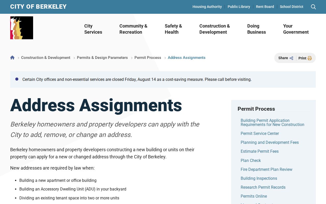
That address history can explain why a family, parcel, or directory entry seems to vanish when the modern ZIP and unit label are used too early.
ABC Reports Add ZIP Context
The California Department of Alcoholic Beverage Control license lookup is one of the few researched tools that accepts ZIP and city reporting modes. It can search license number, licensee, address, city, DBA, and report by city, ZIP, county, tract, or type. That makes it useful for tracing a business name, a public-facing address, or a neighborhood commercial clue. It does not convert a licensee, business address, or voluntary filing into a list of residents.
Use the California ABC ZIP-capable license lookup to test the reporting modes before reading a result as local context.
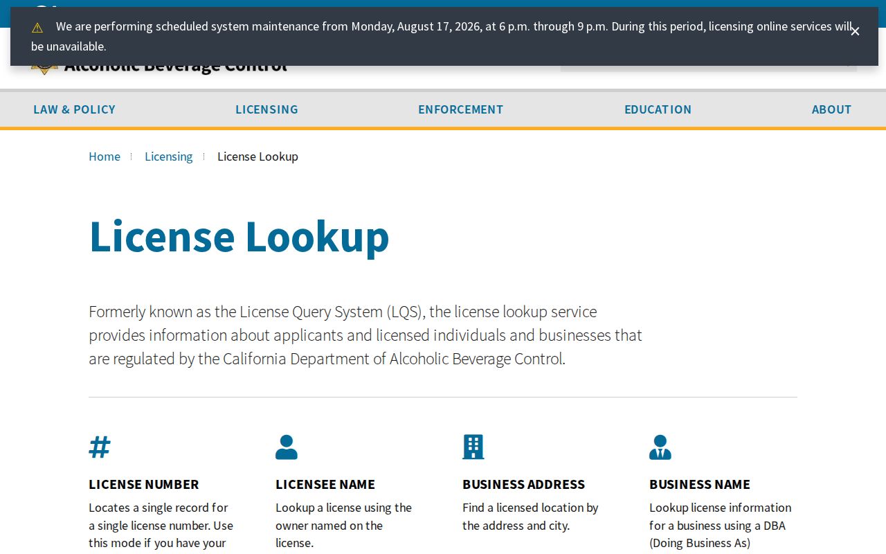
A license result is best kept as an affiliation or place clue. Confirm the physical jurisdiction with USPS and Berkeley GIS, then use the proper custodian for a permit, property, court, or vital question.
Honest Limits for Berkeley ZIP Lookups
A Berkeley ZIP directory can organize postal geography, but it cannot invent resident counts, fill the gap in the county tax portal, or bypass voter privacy. A city ZIP may extend into another city. A property result may separate situs and mailing addresses. A parcel schema may include building size, lot size, use, values, and a latest document date while omitting a public owner field. These are useful facts, but they are not an occupancy roll.
| Question | Best first source | What remains unproven |
|---|---|---|
| Where does mail go? | USPS address lookup | City or county jurisdiction |
| Which parcel is it? | Berkeley GIS and Alameda property search | Current occupant or full household |
| Which entity uses the address? | ABC, DCA, or bizfile metadata | Residence or complete affiliation |
| Can a voter be checked? | My Voter Status | Anyone else's block or street roster |
Good ZIP research ends when the correct custodian takes over. Keep the postal route, city line, county, APN, and source date in your notes. That modest discipline is what keeps a postal code useful without making it claim more than the record can show.